Industrial Archaeology in California
Updates
My interest in Industrial Archaeology is exploring abandoned sites. It's also
nice to know some of the history that goes along with a place, but for me
actually being there and walking through the ruins is the primary motivation.
Richmond, etc.
-
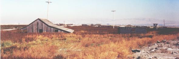
America's Last Whaling Dock , A
burnt out pier near Pt. San Pablo. Richmond, CA.
"Where is Pt. San Pablo, its not on my map?" Take the last exit off of 580,
just inches before you encounter the toll boths heading west over the bridge.
This is Western Dr. Drive to the end of that. Near the end of that, there is a
poor road (dirt I think) that heads up the hill and then back down again on the
otherside. Eventually you will get to Pt. San Pablo, a totally isolated
community of boat house people. Please respect their privacy. There is a small
cafe where you can get a hamburger and read old issues of National Geographic.
Follow the train tracks until you get to the whaling pier, if there is anything
left of it (I seem to remember a story that it was finally torn down). If it
isn't there, it is still worth the trip to Pt. San Pablo and the walk along the
old tracks.
-
Pt. Pinole. This park used to be the site of the Giant explosives
factory . The road to Pt. Pinole is still named after the factory. There are
still ruins visible around the park, including earth berms that presumably were
built to contain explosions. There were several explosions at the factory.
-
Hercules Powder Works
site in Hercules. Not much is left at the former dynamite and nitroglycerin
plant. The plant had an explosive past; blasts periodically rocked Hercules and
Pinole. During the plant's first 38 years, 59 people were killed. The worst
accident was in 1908, when 24 men were killed in one explosion. In 1953 the
last major explosion killed 12 workers. During World War II, the plan was the
largest producer of dynamite in the world. It was built in 1879 by California
Powder Works of Santa Cruz. In 1976, the plant was sold.
-
The Navy's Mothball fleet in Suisun Bay, near Benicia. With a boat, you
can legally get close enough to take pictures of the boats. If you want to
board the boards, you'll need to figure out that on your own -- they are closed
to the public. These ships are from all over-- some are merchant ships, some
are military. Some of the ships were made in the Richmond shipyards during the
World War II boom.
Berkeley, etc.
-
Lawson Adit
,A mining tunnel on the campus of UC Berkeley.
-
Nike Missile Site in Tilden Park , Berkeley CA. From Inspiration point, take
the Nimitz Way bike path to the very end. A top a little hill, you will see
pads of concrete connected by some roads. This used to be a Nike Radar tracking
site in the 1960's. The site was demolished in the 1970's because the missiles
were obsolete. The missile launch pad was somewhere else, down in the valley
somewhere I think. If you poke around, you can see that there is a lot of
concrete, rebar and wire buried underneath the dirt. I wouldn't be surprised if
all of the construction debris was actually buried on the hill, rather than
trucked off to some other landfill. For more Nike info, try the
web site
.
-
Point Albany
. This is a landfill site near Golden Gate Fields (take the exit north of
Gilman and park near the water). There is a lot of rebar and concrete here to
explore, some of it has been turned into industrial art by an anonymous artist.
Watch out for the homeless camps.
-
Point Isabel. Along the southern shore (just next to the CostCo
parking lot) is the site of TEPCO's trash pile . If you walk along the water,
you will find billions of pieces of smashed pottery , so of it still bearing
the "TEPCO" insignia. I don't know the history of TEPCO, except that they
produced plates and cups for restaurants probably more than 50 years ago.
-
Key Route System. Berkeley used to have an intricate system of
electric trains, but the automotive industry bought them up and destroyed the
whole system. This is the same story of the Los Angeles train system. There
isn't much evidence left, except for the tunnel on Henry St. under the
fountain, which used to be for the train only. Also, Key Route through Albany
was the route of the train, now used by BART. Apparently the tracks still lie
under asphalt on Shattuck Ave. in Berkeley. A good website is here.
-
(this was reported by someone else) On 7th st. between ashby and dwight is the old
colgate palmolive factory. It is in 2 parts and the big section is
halfway demolished. All doors and stairs are bolted shut so i didn't go above
the first floor. There's some very cool old signs listing bizarre chemicals and
ominous sounding hazardous waste warnings . The second part is where the train
used to come in to get the soap or whatever. It is halfway knocked down too but
is much cooler to explore- it was made of wood (the other is concrete), and it
has 2 floors and ladders and tools lying around as well as some cool signs and
industrial equipment. There are no squatters or anyone becuase it's supposed to
be locked every day and has barbed wire fencing. I got in during the day at
about 1pm-there is a bldg. down at the end of the street that seems to exist
only to store construction equipment and have guys moving it in and out. When
their gate is open, it is free access to all the colgate property. I rode in on
my bike and rode right past 2 guys and just looked at them like i was
confused-they didn't care either way. I highly recomend a mountain bike as it
is perfect territory, (piles of rubble from demolished bldg.s) and enables you
to get out fast-if you have to you could climb the back fence and get away to
the train tracks and drop down into aquatic park. The one scary thing is that
the lawrence berkeley national lab has their central receiving complex right in
front of all this (facing onto 7th st). they have their gate open in back
during the day and that opens on the colgate property. and since they deal with
classified weapons [not really - Mark] and things they are very big into
security so they will come and chase you off if they see you. But I managed to
avoid them for at least 40 min., (they came after me and i got away on my
bike)-they saw that all i was doing was taking photos so they weren't too
concerned. (they walked toward me really slow like they were bored). Anyway
it's a cool spot-have fun.
Oakland, etc.
-
 USS Hornet
. This air craft carrier is now a museum in Alameda. It served the United
States from an outstanding record against the Japanese in World War II, through
the Vietnam war, and to the rescue of the Apollo 11 capsule, the first manned
mission to the moon. $14 admission. You get to wander the first level,
including crew briefing rooms, mess hall, officers quarters. The main hanger
deck is large and newly painted and not terribly exciting. Here you will find a
flight simulator ($3) which simulates a Desert Storm attack from a carrier. The
main deck is pretty rusty, but should be treated with respect. While the ship
was never hit by enemy fire, many brave men died while attempting extremely
dangerous landings on her deck. Today, it is hard to get a sense of the blood
and sweat that was shed on the boat in her past - try to imagine what it must
have been like during war time conditions. The island (the control tower) is
interesting: it is stationed with volunteers who give mini tours of the
navigation, admiral's and captain's rooms. Most of the ship is still pretty
dingy, making it more interesting I think. The ship was sold for scrap a few
years ago, but rescued by enthusiasts before the dismantler could get the
permits. To get there, take the Webster tunnel from Oakland, and then follow
the signs to the USS Hornet, situated in the now barren Alameda military base.
The engine room, foc'sle, and Marine Detachment are now open so there's lots
more to see. They are closed on Tuesdays.
USS Hornet
. This air craft carrier is now a museum in Alameda. It served the United
States from an outstanding record against the Japanese in World War II, through
the Vietnam war, and to the rescue of the Apollo 11 capsule, the first manned
mission to the moon. $14 admission. You get to wander the first level,
including crew briefing rooms, mess hall, officers quarters. The main hanger
deck is large and newly painted and not terribly exciting. Here you will find a
flight simulator ($3) which simulates a Desert Storm attack from a carrier. The
main deck is pretty rusty, but should be treated with respect. While the ship
was never hit by enemy fire, many brave men died while attempting extremely
dangerous landings on her deck. Today, it is hard to get a sense of the blood
and sweat that was shed on the boat in her past - try to imagine what it must
have been like during war time conditions. The island (the control tower) is
interesting: it is stationed with volunteers who give mini tours of the
navigation, admiral's and captain's rooms. Most of the ship is still pretty
dingy, making it more interesting I think. The ship was sold for scrap a few
years ago, but rescued by enthusiasts before the dismantler could get the
permits. To get there, take the Webster tunnel from Oakland, and then follow
the signs to the USS Hornet, situated in the now barren Alameda military base.
The engine room, foc'sle, and Marine Detachment are now open so there's lots
more to see. They are closed on Tuesdays.
-
 On board
the USS Hornet are two F-8 fighter planes
. One is intact, while the other one looks like it had a pretty interesting
history after it crashed. It is missing the wings. The interior was filled with
what looks like beach sand. The nose was apparently filled with concrete, which
someone has begun chipping away, revealing the original controls and wires. It
is now being restored by a group of Marine Reserves and is looking better.
On board
the USS Hornet are two F-8 fighter planes
. One is intact, while the other one looks like it had a pretty interesting
history after it crashed. It is missing the wings. The interior was filled with
what looks like beach sand. The nose was apparently filled with concrete, which
someone has begun chipping away, revealing the original controls and wires. It
is now being restored by a group of Marine Reserves and is looking better.
-
The old Oakland Amtrak station. If you drive on the new section of 880
In Oakland that passes through west oakland, and look out to the east, you will
see the train station. Apparently, the train tracks (now gone) were elevated,
since the platforms are on the upper floor of the train station. An interesting
place to explore, but the neighbor is probably not the safest place to be. The
station was still in use in the 1990's, but it looks like it was abandoned 50
years ago!
Marin County
-
 Tiburon Naval Net Depot.
During World War II, it was feared Japanese submarines and/or torpedos would
enter San Francisco bay, so an underwater steel net was constructed to catch
anything below the water level. At the Net Depot, on the back side of Tiburon,
the net was built and stored. Also on this site, the parts for the Golden Gate
Bridge were stored when it was being constructed in the 1930's. I haven't
explored it yet. To get there, you might have to trespass. Not sure. More
information here
Tiburon Naval Net Depot.
During World War II, it was feared Japanese submarines and/or torpedos would
enter San Francisco bay, so an underwater steel net was constructed to catch
anything below the water level. At the Net Depot, on the back side of Tiburon,
the net was built and stored. Also on this site, the parts for the Golden Gate
Bridge were stored when it was being constructed in the 1930's. I haven't
explored it yet. To get there, you might have to trespass. Not sure. More
information here
-
The lifeboat ramp at the end of the Marin Headlands..
-
 The Nike site in the Marin Headlands -- well
worth going to on a sunday to see them raise and lower the missles!
The Nike site in the Marin Headlands -- well
worth going to on a sunday to see them raise and lower the missles!
San Francisco
Sorry I don't have more details. I'm just writing these down before I forget...
-
The Sutro Bath ruins
-- open for exploring. Park near the Cliff House or Ocean beach
-
The Fleishacker bath ruins
-- in the parking lot for the SF Zoo (opposite the entrance, currently boarded
up). Not much to see, but interesting fact: this was one of the biggest salt
water swimming pools in the world. Now it is the parking lot (actually, it was
much bigger than the parking lot!).
-
Fort Point, under the Golden Gate bridge.
-
The gun batteries
near the presidio
-
More gun batteries at Fort Funston. More of the WWII gun implacements,
then the Korean/Vietnam era Nike Missle Site. The parking lot is the actual
missile site! The bunkers are still underground! Visit the Nike Missile park in
Marin to see what it looks like underground...
San Jose and south SF bay
Theatres in the Bay Area
In order of most impressive first,
-
The most glamorous theatre west of the Mississippi, the
Paramount Theatre
is in downtown Oakland. They occasionally have $5 movie nights on Fridays. Very
old-timey and cheesy, it is still fun to be in the theatre, like you are in the
Emerald City of the Wizard of Oz.
-
The newly restored California Theatre
in downtown San Jose. If you like architecture, you owe yourself a movie
showing at the California Theatre. It's not a ruin, but a really nice theatre,
totally restored and beautiful.
-
Also check out the Stanford Theatre
in Palo Alto, and while we are at it ...
-
The Castro Theatre in the Castro district of San Francisco is another
wonderful old theatre.
Southern California
Los Angeles
Palos Verdes/San Jose, Southern California
-
 Check out all the pictures and
news clippings of the Dominator shipwreck
in Palos Verdes Estates, CA.
Check out all the pictures and
news clippings of the Dominator shipwreck
in Palos Verdes Estates, CA.
-
Check out the separate webpage on Whites Point
.
-
Ft. McArthur military museum in San Pedro, Southern CA. Contains a lot of cool
stuff, including a dusty, cobweb filled tunnel that connects the gun turret
with the control rooms. Battery Osgood and Battery Farley are here. There are
very similar to the Batteries in the Presidio.
Other parts of California
-
Bodie ghost town. Arguably the best preserved wild west town. Closed in the
Winter, because of massive amounts of snow, unless you are willing to x-country
ski anywhere between 6 and 20 miles from the main highway. You can probably
find some cool links by searching yahoo.com.
Cool Industrial Shit from East Germany
 Just take a look at this Bucket Excavator
from East Germany. It is frickin IMMENSE. Wouldn't you like to discover this on
another planet? Here is a more recent photo of the Bagger
288
Just take a look at this Bucket Excavator
from East Germany. It is frickin IMMENSE. Wouldn't you like to discover this on
another planet? Here is a more recent photo of the Bagger
288
Links to other Industrial Archaeology Resources
Mark Lakata's Home page
 On board
the USS Hornet are two F-8 fighter planes
. One is intact, while the other one looks like it had a pretty interesting
history after it crashed. It is missing the wings. The interior was filled with
what looks like beach sand. The nose was apparently filled with concrete, which
someone has begun chipping away, revealing the original controls and wires. It
is now being restored by a group of Marine Reserves and is looking better.
On board
the USS Hornet are two F-8 fighter planes
. One is intact, while the other one looks like it had a pretty interesting
history after it crashed. It is missing the wings. The interior was filled with
what looks like beach sand. The nose was apparently filled with concrete, which
someone has begun chipping away, revealing the original controls and wires. It
is now being restored by a group of Marine Reserves and is looking better.

 Ghost
Towns of the Santa Cruz Mountains
Ghost
Towns of the Santa Cruz Mountains The Ghost town of Drawbridge,
CA, in San Francisco Bay. Drawbridge was a resort town around the beginning of
the 20th century. Here are
The Ghost town of Drawbridge,
CA, in San Francisco Bay. Drawbridge was a resort town around the beginning of
the 20th century. Here are  The Town of New
Almaden and the New Almaden Quicksilver Mines
The Town of New
Almaden and the New Almaden Quicksilver Mines Creepy
House in Fremont
Creepy
House in Fremont The Pulgas Water Temple
is not really a ruin, but looks old. It is less than 100 years old. This is
only open during normal business hours since it is owned by the water
department! Seriously, it is not open on the weekends! To get to the Pulgas
Water Temple, From Interstate 280 in San Mateo County, exit Edgewood Road.
Drive west to the junction with Cañada Road, and turn right (north). Drive
about 1.5 miles, and turn left into the parking lot.
The Pulgas Water Temple
is not really a ruin, but looks old. It is less than 100 years old. This is
only open during normal business hours since it is owned by the water
department! Seriously, it is not open on the weekends! To get to the Pulgas
Water Temple, From Interstate 280 in San Mateo County, exit Edgewood Road.
Drive west to the junction with Cañada Road, and turn right (north). Drive
about 1.5 miles, and turn left into the parking lot.

 Surfridge
Neighborhood, Playa Del Rey, CA
Surfridge
Neighborhood, Playa Del Rey, CA